Sanborn Maps | home
700 W. Beach | 600 W. Beach | 500 W. Beach | 400 W. Beach | 300 W Beach | 200 W. Beach | 200 W. Beach Cont | 100 W. Beach | 100 W. Beach Cont | 100 E Beach | Market Street | 100 E Beach Cont | 200 E. Beach | 200 E. Beach Cont | Mexican Gulf | Davis Avenue | 300 E. Beach | 300 E Beach Cont | 400 E Beach | 400 E Beach Cont | 500 E Beach | 500 E Beach Cont | 600 E Beach | 600 E Beach Cont | 700 E Beach | 700 E Beach Cont | Row Houses
100 W. Beach Cont
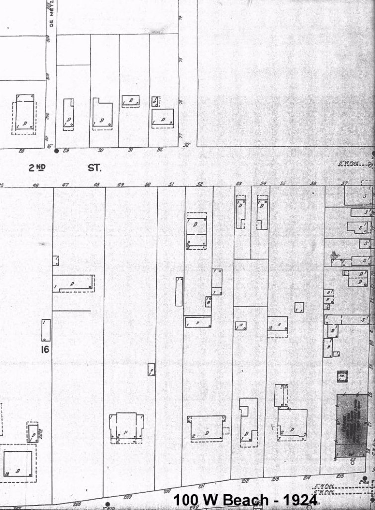
Front Footage and owners from left to right in 1930s
Current Residential addresses shown at right
96 Fitzpatrick Estate (Current Blue Rose) 120
----------------------------------------------(Demetz Avenue extends from Second St)
80 Mrs IL Simpson 118
78 Miss E.M. Dale 116
42 Mrs JC Liversage 110
----------------------------------------------(Clarke Avenue extends from Second St)
75 GP Brandt
50 Mrs Nellie Lang
86 Mrs Nellie Lang
77 Barksdale (Garage shown in black on bottom-right corner) this is the current site of Storage Units
Since Katrina this is vacant lot with green fencing
Market Street
Barksdale, Wares Garage site shown on corner of Market and Beach Blvd.
A Public Market House in 1835
In 1835, after the death of freed Negro, former slave, Charles Asmard had willed his vast acreage to his heirs, Sheriff John Brill dedicated a 15-foot vertical slice of his own property which ran north-south from the Gulf shores. The same amount of right-of-way land adjoining his property was appropriated from an heir of Charles Asmard. The combined right-of-way portions provided a north-south roadway from Bayou Portage to the Gulf in order to allow the Brill's to build a Market Place and allow farmers, sheepmen, and traders a means of accessing the Market House.