Sanborn Maps | home
700 W. Beach | 600 W. Beach | 500 W. Beach | 400 W. Beach | 300 W Beach | 200 W. Beach | 200 W. Beach Cont | 100 W. Beach | 100 W. Beach Cont | 100 E Beach | Market Street | 100 E Beach Cont | 200 E. Beach | 200 E. Beach Cont | Mexican Gulf | Davis Avenue | 300 E. Beach | 300 E Beach Cont | 400 E Beach | 400 E Beach Cont | 500 E Beach | 500 E Beach Cont | 600 E Beach | 600 E Beach Cont | 700 E Beach | 700 E Beach Cont | Row Houses
700 E Beach Cont
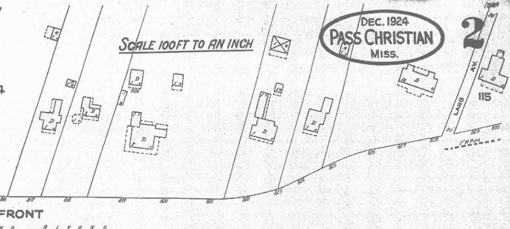
Front Footage and owners from left to right in 1930s and 1950s
Current Residential addresses to right
Allen Hackett 65 733
Presbyterian Parsonage 100 737
JO Kelly 300 741/743
Davis Estate 90 753
Davis Estate 60 757
AM Lockett 247 765/767
LANG AVENUE
No further Sanborn Maps were shown east of Lang Avenue,
indicating City Boundary limits for that era.